Fall is in full force, and the urge to get out and ride grows stronger as the days get cooler and the leaves more colorful. Autumn adventures await on these easy bike trails that offer great vistas to enjoy along the way. Don’t forget a helmet, a tracking app, a water bottle, and a few snacks for the road. Air up the tires, then pick one of these routes and start pedaling.
1. Katy Trail State Park
Machens to Clinton, Missouri
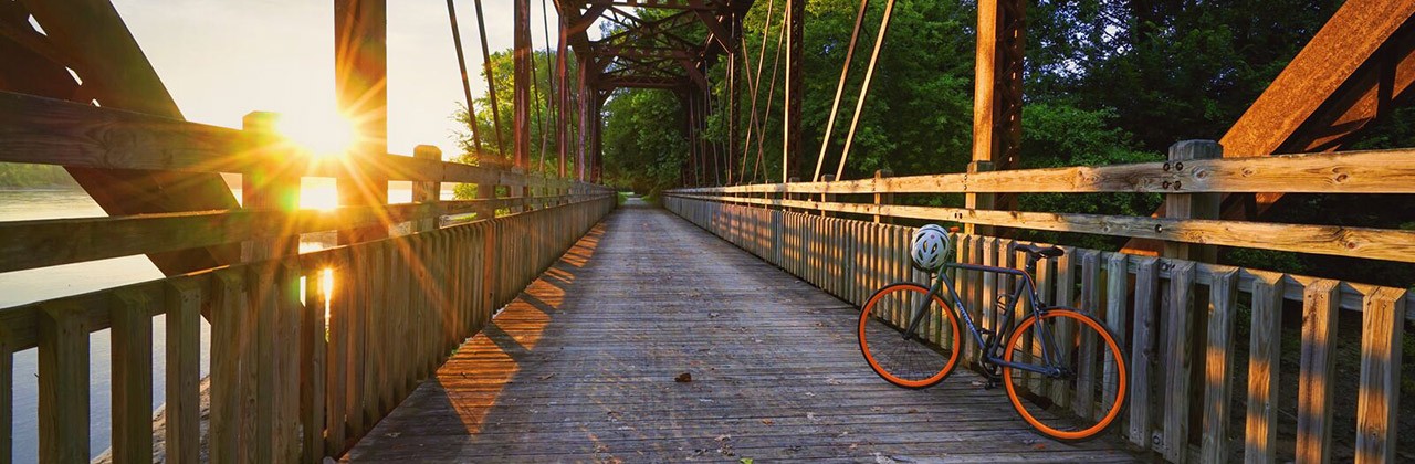
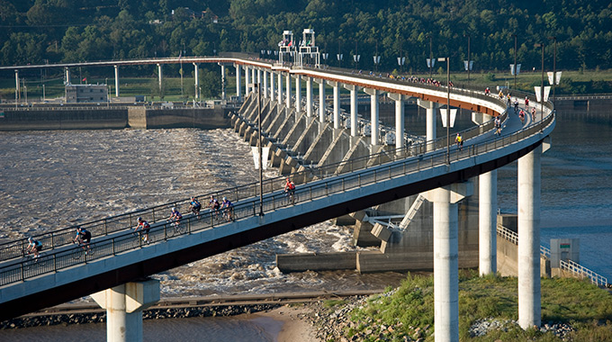
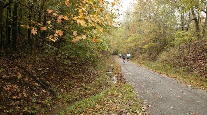
The 240-mile Katy Trail State Park showcases some of Missouri's most scenic places.| Photo courtesy VisitMo.com
At 240 miles, Missouri’s Katy Trail State Park is the country’s longest developed rails-to-trails route, running nearly the entire width of the state and linking Machens in the east with Clinton in the west. Cyclists and hikers of all ages use the trail, which is easy to access with 26 trailheads and 4 restored railroad depots. Following the Missouri River much of the way, the path offers striking vistas at various points, including Augusta on the eastern end, where you’ll pass limestone bluffs and wineries where you can stop for a sip.
You may also like: Where to savor spectacular fall foliage
2. MKT Nature and Fitness Trail
Columbia, Missouri
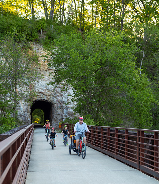
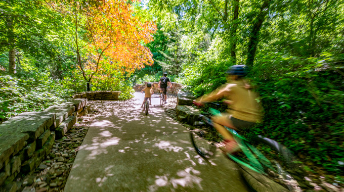
Starting in downtown Columbia, the MKT Nature and Fitness Trail passes through peaceful forested terrain southwest of town. | Photo courtesy VisitMo.com
Like the Katy Trail, the MKT Nature and Fitness Trail in Columbia is built on an old Missouri-Kansas-Texas (MKT) railbed. Cyclists, runners, and walkers use the 9-mile trail, which runs from Flat Branch Park near downtown Columbia to the Katy Trail near McBaine. With a dozen access points, the 10-foot-wide trail cuts through wooded hillsides and passes interesting rock formations. You can pedal the length of the route without ever crossing a street, as it was routed under several roads.
3. Riverfront Heritage Trail
Kansas City, Kansas, and Kansas City, Missouri
With great city and river views, the Riverfront Heritage Trail links the Kansas and Missouri sides of Kansas City. | Photo by Chad Davis
Whether you live on the Kansas or Missouri side of Kansas City, you can enjoy the bistate Riverfront Heritage Trail that weaves through the historic River Market area, where you can stop for a bite, and the central business district of KCMO. Cross the Kansas River on the Woodswether Bike/Pedestrian Bridge, which offers beautiful river vistas and local artwork, and wander into downtown KCK. You can also follow a segment to Kaw Point Park at the confluence of the Kansas and Missouri rivers, a stopping point of the Lewis and Clark expedition in 1804 and a great spot to take photos today.
You may also like: Tank Trip: What to do in Weston, Missouri
4. Arkansas River Trail
Little Rock, Arkansas
Enjoy lofty views atop the Big Dam Bridge along the Arkansas River Trail. | Photo courtesy Arkansas Tourism
One of central Arkansas’ most iconic cycling routes, the 88-mile Arkansas River Trail loops through Little Rock, North Little Rock, Maumelle, and Conway. See several highlights, including the Clinton Presidential Center and the Riverfront Park, on a 15.6-mile segment from the Clinton Presidential Park Bridge through North Little Rock that circles back to its Little Rock origin via the Big Dam Bridge, one of the country’s longest pedestrian- and bicycle-intended bridges. Take in amazing views 90 feet above the Arkansas River on the 4,226-foot span built atop the Murray Lock and Dam.
5. Razorback Regional Greenway
Northwest Arkansas
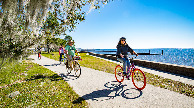
Peddle through scenic areas on the Razorback Regional Greenway, which links arts and entertainment districts of several Northwest Arkansas towns. | Photo courtesy Arkansas Tourism
Northwest Arkansas’ 37-mile Razorback Regional Greenway runs from Fayetteville to Bella Vista, with numerous trail access points, and is one of the reasons the region has become a cycling mecca. Surrounded by natural beauty, the gorgeous trail offers a variety of rest stops and offshoots, including lakes, parks, museums, cafés, and breweries. In addition to passing through charming downtown districts, you’ll enjoy open spaces and cross lots of scenic bridges on this mellow ride suitable for all skill levels.
6. Longleaf Trace
Hattiesburg to Prentiss, Mississippi
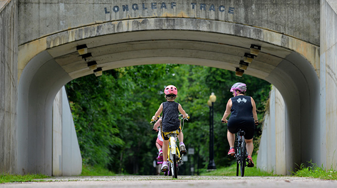
A National Recreation Trail, the rails-to-trails Longleaf Trace cuts through southeast Mississippi's Piney Woods region. | Photo courtesy Visit Mississippi
A 44-mile rails-to-trails paved route used for cycling, hiking, running, and rollerblading, the Longleaf Trace bills itself as southern Mississippi’s premier trail. Indeed, the federal government designated it a National Recreation Trail, and the Rails-to-Trails Conservancy added it to its Rail-Trail Hall of Fame. Following the former Mississippi Central Railroad line between Hattiesburg and Prentiss, the trail cuts through bucolic farmland, rolling hills, piney woods, wetlands, and small towns. You’ll find 8 rest areas and 3 small shelters along the way. There’s also a 24-mile parallel soil route for equestrians.
7. Pigeon Creek Greenway Passage
Evansville, Indiana
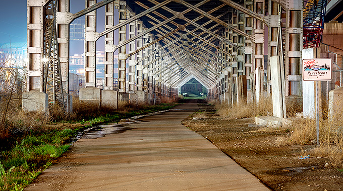
Pigeon Creek Greenway Passage hugs the banks of the creek and the Ohio River in Evansville. | Photo by C Hanchey
The Pigeon Creek Greenway Passage winds through the heart of Evansville and follows the banks of the creek and the Ohio River. To date, almost 7 miles of paved trail have been completed, and eventually the pathway will encircle the city. The 10-foot-wide paved route with easy curves and hills attracts cyclists, walkers, joggers, and skaters. You’ll pass interesting sculptures and signs along the way that tell the story of Evansville. A National Recreation Trail, the path connects neighborhoods, parks, and nature areas with the city’s downtown riverfront.
You may also like: Discover important civil rights sites in the Midwest and South
8. Tunnel Hill State Trail
Vienna, Illinois
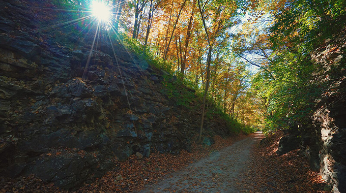
Highlighted by many tunnels and trestles, the rail-to-trail Tunnel Hill State Trail explodes in color during the fall. | Photo courtesy Illinois Department of Natural Resources
Another railroad bed turned cycling and hiking trail, southern Illinois’ Tunnel Hill State Trail stretches 45 miles between Harrisburg and Karnak. The Norfolk Southern Railroad gave the right of way to the state in 1991 for this route, which is mostly covered by a tree canopy. Passing through forests and farmland, you’ll cross 23 trestles and navigate a 543-foot tunnel. A 2.5-mile spur leads from Karnak to the pristine Cache River State Natural Area and Barkhausen-Cache River Wetlands Center.
Choose a section that suits your skills and fitness level. For starters, try the fairly easy stretch from the Tunnel Hill Trailhead to the Breeden Trestle for a 5.2-mile round-trip that includes the route’s eponymous tunnel. You’ll want to use your bike light or bring a flashlight for the pitch-black tunnel, which is longer than a football field. Continue to Breeden Trestle, the trail’s highest (90 feet) and longest (434 feet) trestle. Take time to admire the view from the trestle’s 3 lookout decks before turning and heading back to the starting point.
9. Tammany Trace
Louisiana Northshore
Bicyclists on the Tammany Trace often pedal along the Mandeville lakefront a few blocks away. | Photo courtesy LouisianaNorthshore.com
Louisiana’s first rails-to-trails conversion, the 31-mile Tammany Trace runs from Slidell to Covington on the former Illinois Central Railroad corridor in St. Tammany Parish. The asphalt trail is suitable for cycling, hiking, skating, and wheelchair use. An equestrian path runs parallel to some sections. As you pedal through urban, suburban, and rural areas brimming with loblolly pines, live oaks, and magnolias, be sure to stop frequently to take in the vistas from the 31 railroad trestles converted into pedestrian bridges. Stop off for a rest and a bite to eat in the charming towns of Abita Springs, Mandeville, and Lacombe along the way.
You may also like: Must-visit museums in New Orleans
10. Baton Rouge Levee Bike Path
Baton Rouge, Louisiana
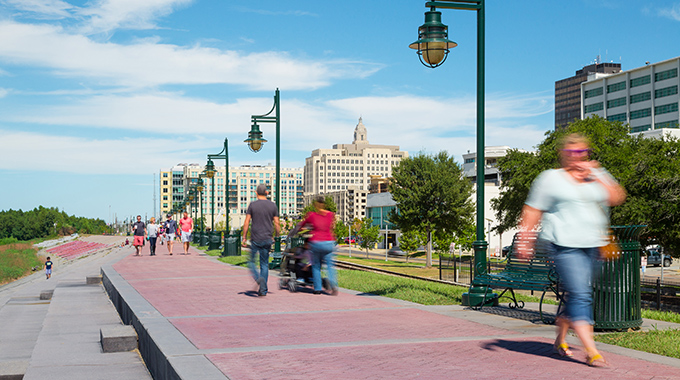
The Baton Rouge riverfront promenade forms part of the Baton Rouge Levee Bike Path. | Photo courtesy Baton Rouge Downtown Development District
Biking along the levee is a great way to get an up-close look at the mighty Mississippi River as it rolls past Baton Rouge, Louisiana’s capital. The Baton Rouge Levee Bike Path begins at the southern end of the city’s 1-mile riverfront promenade and extends for 4.3 miles as a 15-foot-wide paved path with separate lanes for bicycles and pedestrians—complete with lighting, seating, and water fountains. From the pathway, you can access Louisiana’s Old State Capitol museum, the Louisiana Art and Science Museum, and the USS Kidd Veterans Museum.
The path continues beyond Baton Rouge along the levee to Carville, with some parts unpaved. Many hope that one day a finished trail will stretch all the way to New Orleans.
An outdoor enthusiast, Barbara Gibbs Ostmann is a freelance writer from Gerald, Missouri.
You may also like: Visiting Baton Rouge: What to see and do
Travel offers & deals


